How to find your property boundaries
On this page
Search a covered street address on MapMyLot to see the mapped parcel boundary, lot size and perimeter. Five lookups a day are free with no account needed. Choose the relevant region guide below for local data and coverage details, and use a licensed surveyor when you need to establish a boundary on the ground.
Find your property boundary now
Check an address freeFree for the first 5 lookups a day - no account needed.
How the boundary lookup works
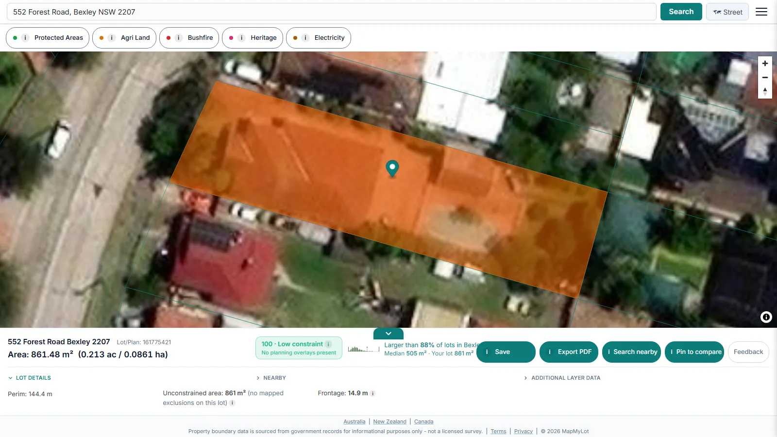
MapMyLot pulls parcel geometry from the same cadastral datasets councils, state land registries, and national mapping agencies publish. Searching an address matches it to that parcel, draws the boundary polygon on the map, and calculates the enclosed area and the perimeter length automatically - no manual measuring, and no separate report to request.
What you get from a boundary search

Every search returns the boundary polygon on the map, the lot area (in square metres and hectares/acres), and the perimeter length. Where MapMyLot's proximity and overlay layers are loaded for that address, the same search also surfaces how close the parcel is to flood zones, the coast, power lines, parks, and waterways - all from one lookup.
Find your region's boundary guide
MapMyLot's boundary coverage spans four regions. Each has its own guide with region-specific tips on address formats, data sources, and known coverage gaps:
- Queensland property boundary maps
- New South Wales property boundary maps
- Victorian property boundary maps
- Reading NZ satellite boundary overlays
- How to find your property boundary in New Zealand
- British Columbia property lines map
- England and Wales property boundaries
Before you rely on it
A MapMyLot boundary lookup is a fast, free starting point for research - checking a lot before an offer, confirming a rough fence line, or sanity-checking a listing's stated land size. It draws from published cadastral data, which is accurate for planning purposes but is not a certified survey. For a boundary dispute, a fence built on the line, or any decision that needs a legally binding answer, engage a registered surveyor for an identification survey.
For a wider read on what else a single address search can tell you, see the proximity overview covering flood, coast, power line, park, and waterway distance.
Victorians can also use the state's own tools, and we cover each one: MapshareVic for the general property viewer, the LASSI map for survey marks and plan search, and Vicmap Property for the cadastral data behind them all.
Find your property boundary now
Check an address freeFree for the first 5 lookups a day - no account needed.