How to find your property boundary in Yukon
On this page
Find a surveyed Yukon parcel on MapMyLot by searching its address or by clicking the lot on the map. The outline loads with its area and perimeter. Five lookups a day are free, with no account needed. Yukon coverage is about 22,800 surveyed parcels from Geomatics Yukon. Use the map for a first look, not as a survey.
Find your Yukon property boundary now - free, no account needed
Check a lot freeFive free lookups a day, no account needed. Additional readouts depend on local data coverage.
Address search in Yukon
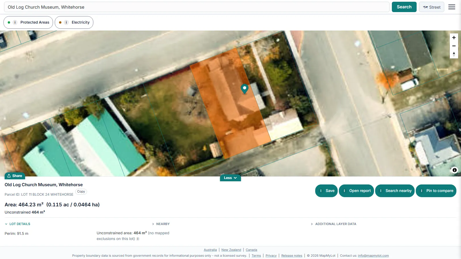
Yukon's surveyed parcel data has no street address field, and the Government of Yukon's own GeoYukon guidance says "Complete address information for the Yukon is currently not available." So MapMyLot finds a Yukon lot in two steps: it places the address you type on the map using OpenStreetMap address data, then shows the surveyed parcel at that point.
That works for some addresses, mostly in Whitehorse, but many Yukon addresses, rural ones in particular, are not in that data or only resolve to the street. When a search does not land on your lot, zoom to it on the map and click the parcel. A click loads the parcel the same way an address search does.
Where the data comes from
The boundaries come from "Land Parcels Polygon - Surveyed", published by Geomatics Yukon under the Open Government Licence - Yukon. The dataset describes a surveyed land parcel as "the spatial extent of a lot or parcel of land", and parcels with an Active status form the current cadastral fabric. It is updated ad hoc, so a new survey may take time to appear. Geomatics Yukon publishes it and names Natural Resources Canada as the data custodian.
Parcels carry a parcel designator, such as a lot and block number, rather than a street address. Only surveyed parcels are in this dataset, so land that has not been surveyed into a parcel shows no boundary.
GeoYukon and First Nation Settlement Lands
GeoYukon is the Government of Yukon's public mapping platform. It runs in a browser with no special software, and its land layers include surveyed parcels, easements and parcel addresses, along with land tenure, land use permits and land claims. Use it for details MapMyLot does not show, such as easements.
Yukon also publishes a surveyed cadastral framework for First Nation Settlement Lands. Settlement land is land identified in a First Nation's land claim agreement, and it comes in three types: Category A (ownership of surface and subsurface), Category B (ownership of the surface only) and Fee Simple (private ownership). Geomatics Yukon notes that some Settlement Land surveys are not yet complete. If a lot sits next to Settlement Land, check that layer in GeoYukon.
What you get from the search
The readout shows land area in square metres and hectares and perimeter in metres. A free protected areas layer, from the Canadian Protected and Conserved Areas Database published by Environment and Climate Change Canada, shows parks and conservation areas. MapMyLot Pro adds an electricity overlay of Yukon Energy transmission lines, labelled by voltage, from 34 kV up to 138 kV.
Distances to power lines, parks, water and the coast are not available for Yukon lots. Pro costs C$29.99 a month, removes the five-a-day limit and includes unlimited PDF reports. A single PDF report costs C$19.99 without a subscription. To compare with the neighbouring province, read the British Columbia guide. For the general method, read how to find property boundaries.
Check a lot in three steps
- Open the map and search the address with the community name, for example Whitehorse, or zoom to the area.
- If the search does not land on your lot, click the parcel on the map.
- Read the area and perimeter, switch to satellite view for context, and compare the outline with your survey plan or title.
When you need a survey
A map outline does not settle where a boundary sits on the ground. Natural Resources Canada counts lands in the Yukon among Canada Lands. Surveys there are carried out by Canada Lands Surveyors, who hold a licence from the Association of Canada Lands Surveyors, and the Surveyor General Branch checks those surveys before entering them in the Canada Lands Survey Records. For a fence, a building near a line or a dispute, hire a land surveyor and treat the MapMyLot outline as a starting point only.
Find your Yukon property boundary now - free, no account needed
Check a lot freeFive free lookups a day, no account needed. Additional readouts depend on local data coverage.
Property boundary maps by region
Frequently asked questions
What data does MapMyLot use for Yukon property boundaries?
Can I search a Yukon street address?
Does MapMyLot show easements in Yukon?
Is my area included?
Yukon is covered with about 22,800 surveyed parcels. MapMyLot also covers:
- Rest of Canada: British Columbia, Manitoba, and New Brunswick
- Australia: Queensland, New South Wales, Victoria, Tasmania, and the ACT
- New Zealand
- UK: England, Wales, and Scotland