MapshareVic: how to use Victoria's free property map
On this page
MapshareVic is the Victorian Government's free interactive property map, run by the Department of Energy, Environment and Climate Action (DEECA) at mapshare.vic.gov.au/mapsharevic. It covers four map themes - Forest, Public Land, Water, and Property - and lets you search by address, SPI (standard parcel identifier), locality, or local government area, then generate a property report for the result. It is a capable tool, but it is also a general-purpose government GIS viewer with a learning curve; if all you want is a boundary, area, and perimeter for one address, a plain search on MapMyLot gets there in seconds with no map navigation required.
Search a Victorian address on MapMyLot - free, no account needed
Check an address freeFive free address lookups a day, no account needed. Additional readouts depend on local data coverage.
What MapshareVic does
MapshareVic's Global Search tool matches on address, council property number, SPI, or place name as you type - useful once you know the exact reference, but it means the first few characters of a search may return several suggestions to pick through. Once you have located a property, MapshareVic can identify features on the map, toggle layers on and off, switch basemaps, measure distances and areas, draw shapes, and print or export the result. The Property theme is the one most relevant to a boundary check; the Forest, Public Land, and Water themes serve land-management and natural-resource use cases.
Getting a property report
Search for an address or council property number, select the matching result from the Global Search suggestions, then use MapshareVic's report tool to generate a PDF for that property. This is useful when you need a Victorian Government-branded document for a file, but it takes more steps than a direct address search - MapshareVic is built to browse a wide range of spatial themes, not to answer one address query as quickly as possible.
MapshareVic versus a plain address search
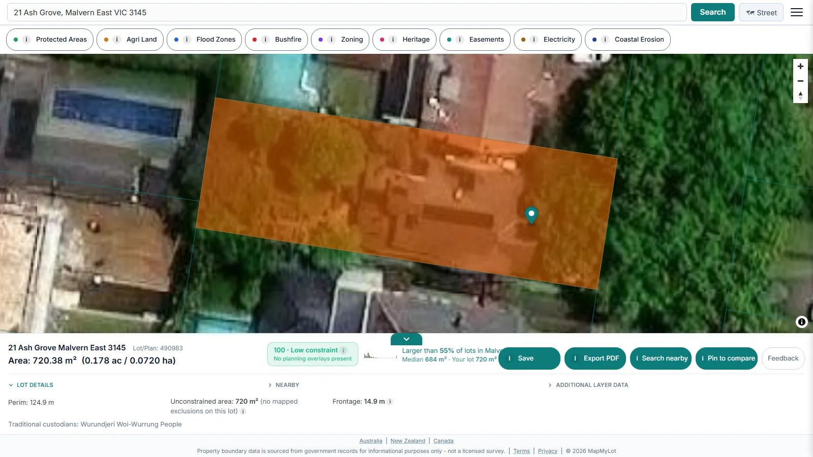
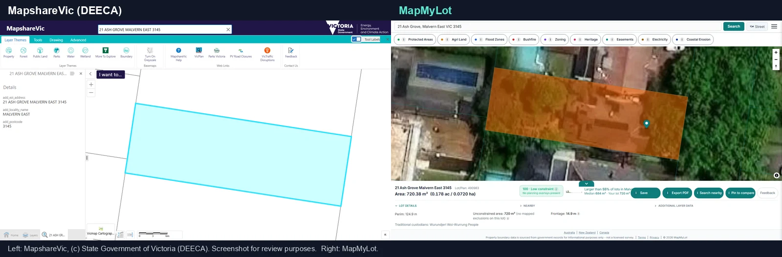
MapMyLot trades MapshareVic's breadth of themes for speed on the one question most people actually have: what is this property's boundary, area, and perimeter. Search a Victorian street address and the boundary loads as a highlighted polygon with area and perimeter in the readout panel, sourced from the same Vicmap Property cadastre MapshareVic itself displays. No theme switching, no report-generation step, and it works the same way on a phone during a property inspection as it does at a desk.
Layer themes versus property answers
MapshareVic's layer themes are organised around land management: forests, public land, parks, water and wetlands. MapMyLot's layers are organised around the questions a property decision turns on. A free search returns:
- The lot itself: the official cadastral boundary over satellite or street view, with area, perimeter, frontage and lot/plan number in one readout.
- How it compares: a lot-size benchmark against the suburb, so you know whether the block is larger or smaller than its neighbours.
- The constraint score: a 0-100 at-a-glance rating of how constrained the lot is by mapped planning layers, with the unconstrained area calculated for you.
- Proximity checks: measured distances from the lot to powerlines, the nearest park, the coast, waterways and other water bodies.
- Two data layers: Protected Areas (every MapMyLot jurisdiction) and agricultural land classification.
MapMyLot Pro adds seven more layers on the same map: Zoning (the planning zone applying to the lot), Heritage (mapped listings; local overlays need a separate check), Easements (registered easements crossing the parcel), Flood Zones, Bushfire, Electricity (transmission lines and easements) and Coastal Erosion. Hazard layers are reported as present or absent rather than averaged into a reassuring rating.
Free to check, Pro for unlimited
Five address lookups a day are free on MapMyLot, no account required. MapMyLot Pro, at A$19.99 a month, removes the daily limit and adds unlimited PDF boundary reports. A single PDF report is also available for A$4.99 without a subscription.
Note: both MapshareVic and MapMyLot display cadastral boundary data as a general reference, not a legally binding determination. For a fence line dispute or a setback that depends on precise legal boundary position, engage a registered surveyor licensed in Victoria.
Related checks
See the LASSI map guide for survey marks and plan search, what Vicmap actually is as the data behind both viewers, or how to find a Victorian property boundary on MapMyLot. For the fundamentals in any state, start with how to find property boundaries.
Search a Victorian address on MapMyLot - free, no account needed
Check an address freeFive free address lookups a day, no account needed. Additional readouts depend on local data coverage.