How to find your property boundary in Tasmania
On this page
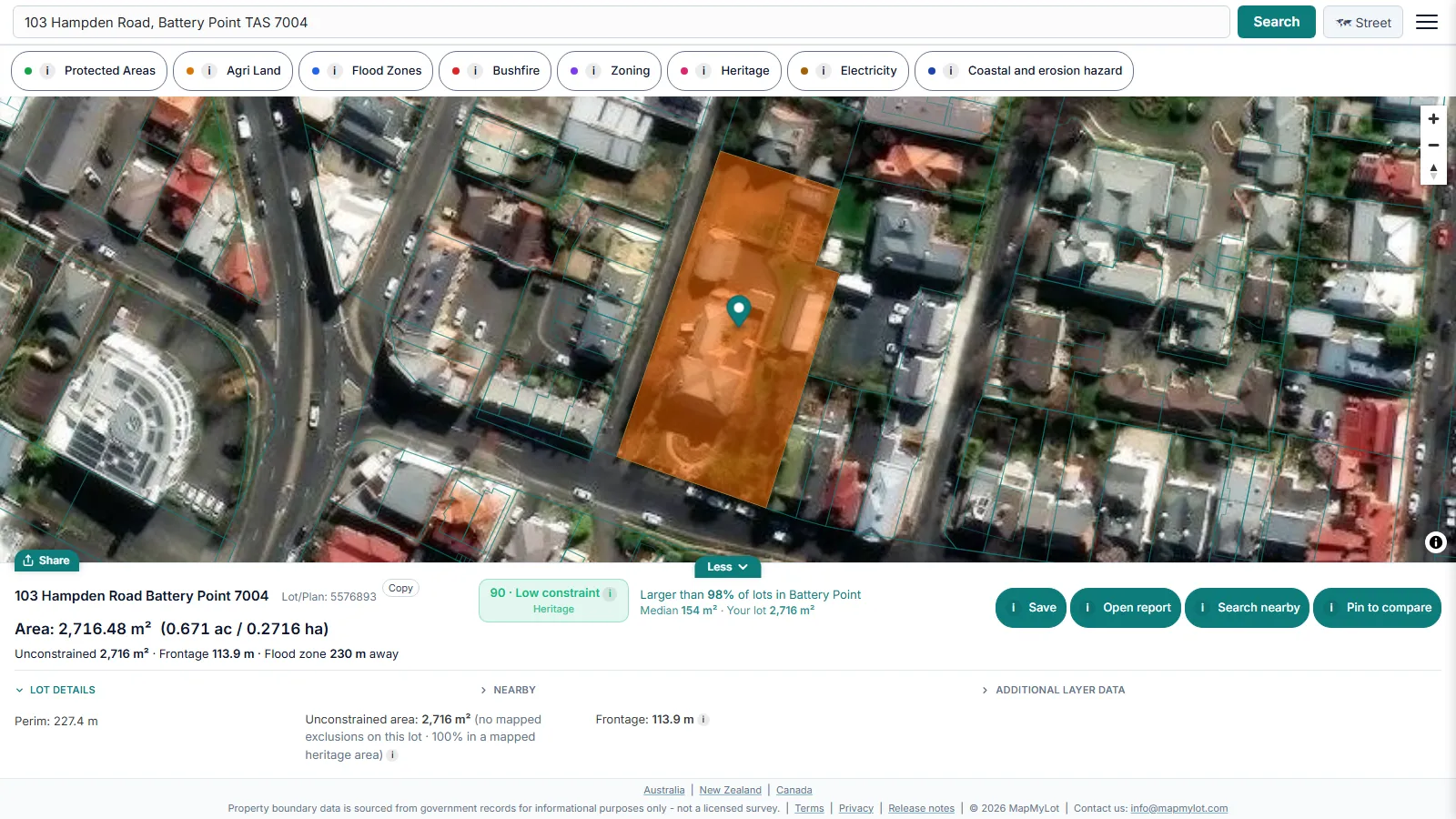
Find a mapped Tasmanian property boundary by searching the street address on MapMyLot. The parcel outline from the State's LIST cadastre appears with its area and perimeter, plus proximity readings where data covers the address. Five lookups a day are free, with no account and no title reference needed. Treat the map as a first check, then confirm with the title or a registered land surveyor when the exact line matters.
Find your Tasmanian property boundary now - free, no account needed
Check an address freeFive free address lookups a day, no account needed. Additional readouts depend on local data coverage.
How Tasmanian land is identified
Land Tasmania keeps property titles in the Land Titles Register "under a volume/folio reference", according to its guide to searching a Torrens title. That reference is printed on the title and in conveyancing papers. If you do not have it, the Land Titles Office says a title can still be found from the plan number and lot number, the address of the property, or by identifying the property on a map or plan.
The LIST Cadastral Parcels dataset also carries a property identifier (PID) for each parcel, alongside the volume and folio fields. You do not need any of these numbers to start: MapMyLot matches the street address to the parcel. For how lot references work in other states, see how to find a lot number in Australia.
LISTmap and what costs money
The State's own viewer is LISTmap, which the LIST describes as "a free, easy to use, online map application". The LIST is managed by Land Tasmania, a business unit of the Department of Natural Resources and Environment Tasmania (NRE Tas). Cadastral parcels are one of its layers, so you can view a boundary there at no cost.
Documents are where the fees start. The LIST fee schedule effective from 1 July 2026 lists:
- Current Land Title Search: $39.20 per document
- Property and Valuation information: $17.29 per report, including GST
Title searches can also be made in person at a Service Tasmania shop or at the Land Titles Office in Hobart. The title and its plan carry the legal description of the land. A map outline does not.
What MapMyLot shows for a Tasmanian address
MapMyLot draws the parcel from LIST Cadastral Parcels (the LIST, State of Tasmania), about 438,000 parcels statewide. Each search shows:
- the parcel outline on a street or satellite base map
- land area in square metres, acres and hectares, and perimeter in metres
- proximity readings, such as distance to the nearest power line, where data covers the address
Two overlay layers are free: protected areas and agricultural land class. MapMyLot Pro, at A$29.99 a month, removes the daily limit and adds Tasmanian Planning Scheme zoning, flood-prone areas, bushfire-prone areas, coastal erosion hazard bands, heritage (the Tasmanian Heritage Register and local heritage listings) and mapped power lines. A one-off PDF report costs A$19.99 without a subscription. For how land area is measured and compared, see lot size in Australia.
How accurate the mapped boundary is
Land Tasmania is direct about the limits. Its page on property boundaries on LISTmap says "these layers are effectively only a digital version of a cadastral index map", that "large, variable and inconsistent position errors in the LISTMap spatial cadastre are possible", and that users "must not rely on this data for the on-ground location of boundaries". It adds that "boundary creation is primarily a legal process".
MapMyLot shows the same cadastral extent, so the same caveats apply. Use the outline to confirm you have the right parcel and to get an approximate size, not to place a fence. The guide to finding property boundaries covers the other records worth checking.
Who confirms a legal boundary in Tasmania
Surveyors in Tasmania are registered under the Surveyors Act 2002. Only registered land surveyors with the Land or ADR-Land specialist competency are "authorised to undertake surveys of property boundaries", and they can "confirm the physical location of property boundaries". Check a surveyor's competency on the Register of Tasmanian Surveyors, published by NRE Tas with the Office of the Surveyor General as its contact.
Check an address in three steps
- Open the map, type the street address and select the matching result.
- Check the highlighted parcel is the one you meant, then read its area and perimeter.
- Compare the outline with your title or plan. If they differ, order a title search or talk to a registered land surveyor before relying on the map.
Find your Tasmanian property boundary now - free, no account needed
Check an address freeFive free address lookups a day, no account needed. Additional readouts depend on local data coverage.
Property boundary maps by region
Frequently asked questions
What data does MapMyLot use for Tasmanian property boundaries?
Do I need my volume and folio to search?
Can I use the map to settle a fence line in Tasmania?
Is my area included?
All of Tasmania is covered, about 438,000 cadastral parcels. MapMyLot also covers:
- Rest of Australia: Queensland, New South Wales, Victoria, and the ACT
- New Zealand
- Canada: British Columbia, Manitoba, New Brunswick, and Yukon
- UK: England, Wales, and Scotland