How to find your property boundary in New Brunswick
On this page
Search a New Brunswick street address on MapMyLot and the parcel outline appears on the map, with its area and perimeter in the readout panel. The outlines come from the Service New Brunswick parcel data, about 603,700 parcels across the province. Five lookups a day are free, with no account and no PID needed. Use the map for a first check, then confirm with a survey or the land registry if the exact line matters.
Find your New Brunswick property boundary now - free, no account needed
Check an address freeFive free address lookups a day, no account needed. Additional readouts depend on local data coverage.
PID versus a street address
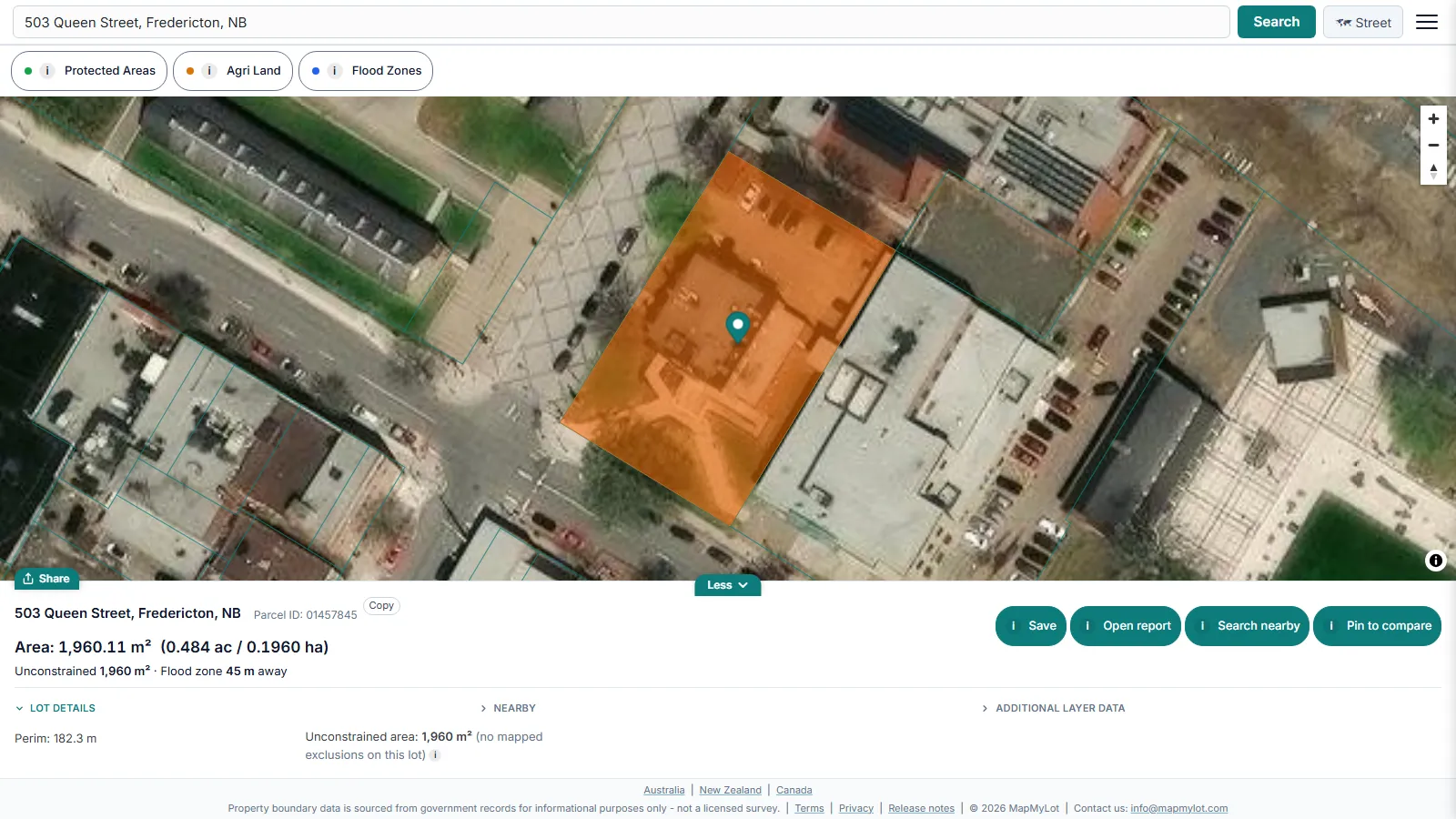
New Brunswick identifies each parcel by its PID (Property Identifier). In the Service New Brunswick parcel data every PID is an eight-digit number, such as 01000009. Few owners know theirs by heart.
MapMyLot works from the street address instead. It finds the matching parcel and highlights it, so you never need to look up the PID first.
Where the New Brunswick outlines come from
The boundaries come from the provincial parcel map service published on GeoNB, the Government of New Brunswick geographic data portal. The service describes itself as "approximate boundaries for all land parcels in New Brunswick" (GeoNB parcel service). It records a PID for every parcel. It also gives each parcel a titles status of Land Titles, Pending Land Titles or Registry.
Service New Brunswick releases its digital property map downloads under the Open Government Licence - New Brunswick, based on version 2.0 of the Open Government Licence - Canada (GeoNB Digital Property Map Downloads). MapMyLot uses that open data.
The province also runs its own public map, the GeoNB Map Viewer. It shows province-wide property layers next to road, water, flood and wetland data. Service New Brunswick offers that viewer and its content without warranties of accuracy, currency or completeness.
What MapMyLot shows in New Brunswick
Every lookup shows the highlighted parcel on a street or satellite map, with land area in square metres and hectares and perimeter in metres. Area and perimeter are measured from the mapped outline, so treat them as approximate, like the outline itself.
Two data layers are free to view: protected areas from the Canadian Protected and Conserved Areas Database, and agricultural land capability from the Canada Land Inventory. MapMyLot Pro adds New Brunswick flood zones from the GeoNB flood hazard mapping. That layer covers the 1-in-20-year and 1-in-100-year open-water flood lines, the mapped flood envelopes, and the areas that flooded in the 1976 and 1987 ice-jam floods.
Parcel data follows the province's own update schedule, so a very new subdivision may not appear yet. A missing lot usually means the source data has not caught up, not that the search failed.
Who confirms a legal boundary
A mapped outline is not a survey. If you are building near a line, settling where a fence goes or buying land where the exact edge matters, hire a New Brunswick land surveyor. The Association of New Brunswick Land Surveyors regulates and governs land surveying in the province, and its site lists its members.
For a wider view of how boundary records work, see how to find your property boundaries. For another Canadian province, see the British Columbia boundary guide.
Check an address in three steps
- Open the map, enter the street address and select the matching result.
- Confirm the highlighted parcel is the one you meant to check, then read its area and perimeter.
- Use satellite view for visual context and review the available readouts. If the parcel or figures do not match your documents, investigate the difference before relying on them.
What to do after your first check
Confirm you have the right parcel, then compare its mapped size and shape with the listing or your documents. If you need a copy for your own research, a one-off PDF property report costs C$19.99. For repeated checks, Pro costs C$29.99 a month and includes unlimited lookups and PDF reports. Compare the options after checking the address. Reports are informational and do not replace a survey or title search.
Find your New Brunswick property boundary now - free, no account needed
Check an address freeFive free address lookups a day, no account needed. Additional readouts depend on local data coverage.
Property boundary maps by region
Frequently asked questions
What data does MapMyLot use for New Brunswick property boundaries?
Do I need my PID to search?
Is the boundary shown a legal survey?
Is my area included?
All of the roughly 603,700 parcels in the Service New Brunswick parcel data are covered. MapMyLot also covers:
- Canada: British Columbia, Manitoba, and Yukon
- Australia: Queensland, New South Wales, Victoria, Tasmania, and the ACT
- New Zealand
- UK: England, Wales, and Scotland