How close is a property to a flood zone, the coast, power lines, parks, and water?
On this page
A single covered address search can show how far a parcel is from mapped flood zones, power lines, coastline, parks, waterways and water bodies. Each reading depends on the data available at that location. Use the numbers to compare properties and identify what to check next; they are not a safety assessment or a walking route.
Search any covered address on MapMyLot and the parcel readout includes a distance to each of these, when data exists for that location. Tap any of the highlighted readout lines and the map jumps straight to the matching feature, the transmission corridor, the flood zone edge, the coastline, the nearest park, or the nearest waterway or water body, so you can see exactly what the number refers to.
Check a property's proximity now
Check an address freeAll six distances are free. Coverage varies by jurisdiction - see each guide for the current list.
Flood zones
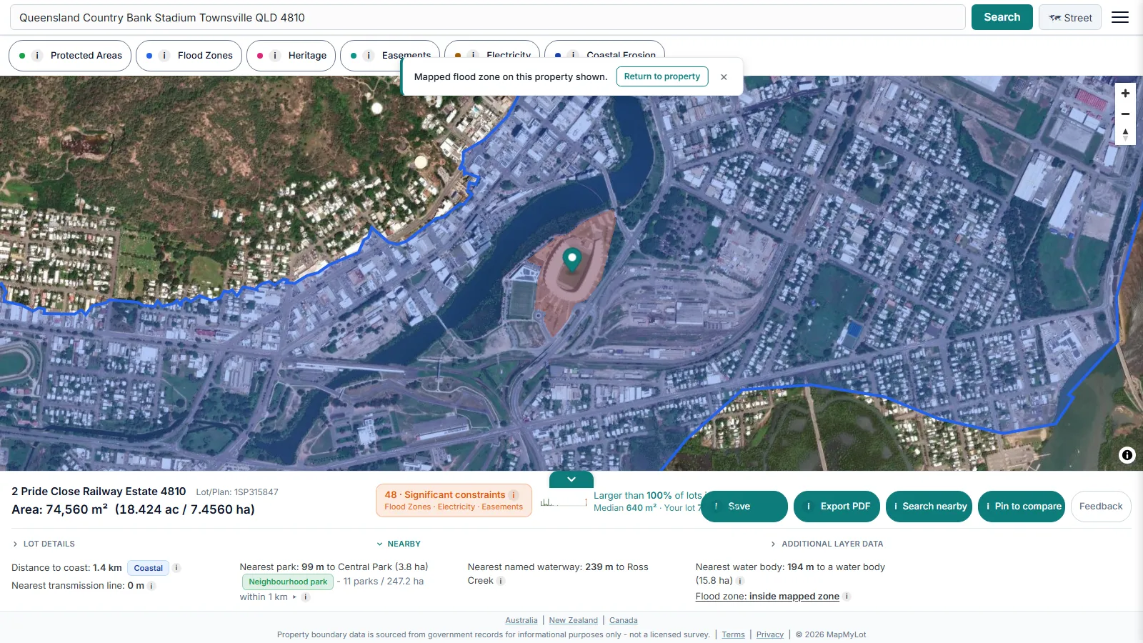
A council's flood study can sit behind a data request nobody thinks to make until the settlement date is already booked. Where mapped flood zone data is available, MapMyLot measures the straight-line distance from the parcel's full boundary to the nearest edge of a mapped flood zone polygon, capped at 5 kilometres so the reading stays meaningful rather than trailing off into irrelevance. A property that intersects a mapped zone is shown as inside it directly, at distance zero, rather than a small positive number that could wrongly read as a safety margin. UK addresses can check the equivalent official service directly at GOV.UK's long-term flood risk checker.
Flood exposure increasingly shows up before settlement, not after: insurers ask about it earlier every year, and a council flood certificate or hydrology report is exactly the kind of document a purchase, build, or insurance decision should not proceed without if the number here raises a question. Treating the MapMyLot reading as a first pass rather than the final word is the honest way to use it.
A zero flood-distance reading means the parcel intersects a mapped flood zone. An absent reading is different: no distance was returned within the display range, or the relevant data is unavailable. Neither should be interpreted as a safety certificate. Flood zone distance is currently live in:
- Victoria
- UK: England, Wales, and Scotland
- New Brunswick
- Queensland (sparse - roughly 20 mapped flood polygons statewide)
Not yet covered: New South Wales, Tasmania, the ACT, New Zealand, British Columbia, Manitoba, and Yukon. Read the full flood zone check guide for the complete breakdown and what an absent reading means.
The coast
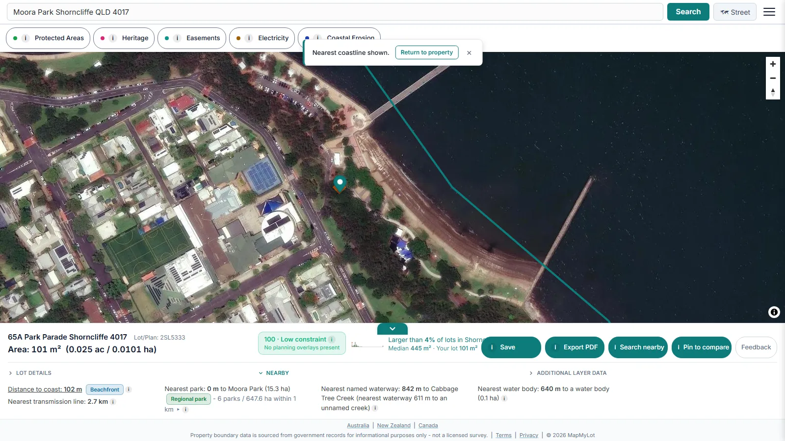
Every second listing near open water calls itself "beachside", whether that means a two-minute walk or a twenty-minute drive. MapMyLot measures the straight-line distance from the parcel boundary to the nearest mapped coastline and assigns a tier so the word means something consistent: beachfront under 150 metres, beachside under 500 metres, coastal under 2 kilometres, alongside the exact distance in metres for anyone who wants the raw number rather than the label. Australian coastline data is sourced from Geoscience Australia.
The gap between a listing's chosen word and the measured distance is exactly the kind of thing worth checking before an offer, not after settlement, since "beachside" carries a real premium in most coastal markets and a twenty-minute drive is not what that premium is paying for. The tier is descriptive, not a valuation, and two properties in the same tier can still differ meaningfully in outlook, elevation, and beach access.
The distance is a straight line over water and land alike, not a walking route, so an inlet, a cliff, or a main road between a property and the water will not appear in the number even though it changes how the distance actually feels on foot. Coverage depends on which coastline datasets have been loaded for that jurisdiction. Read the full coastal proximity guide for exact coverage and tier definitions.
Power lines
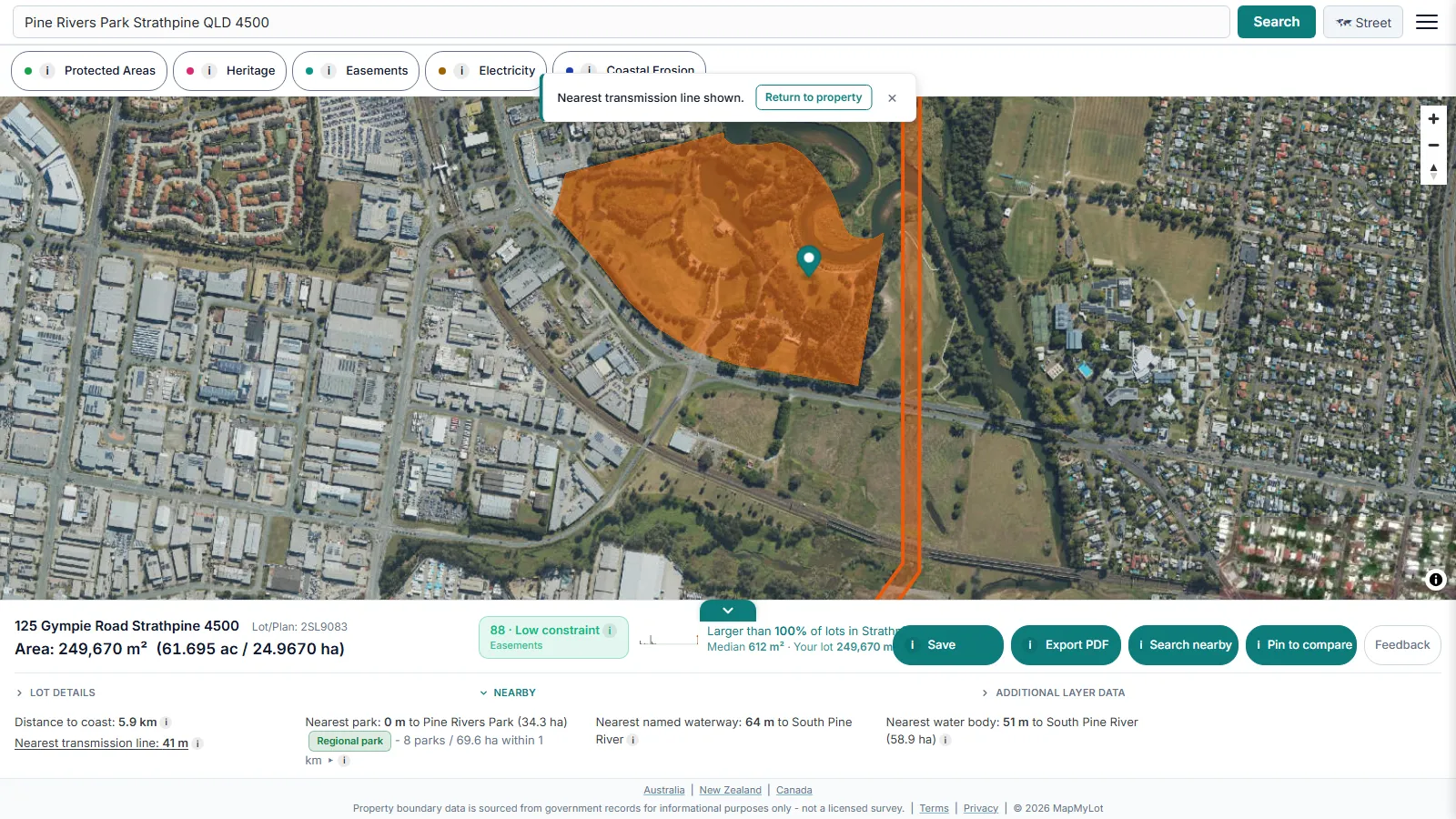
A street can feel quiet enough that nobody mentions the transmission towers at the end of the block until a finance approval stalls on them. MapMyLot measures the straight-line distance from the parcel's full boundary geometry, not a single point, to the nearest high-voltage (33kV or above) transmission corridor. Measuring from the whole boundary rather than the centre matters because a large or irregular lot can have one corner sitting much closer to a corridor than the block's midpoint would suggest. Local distribution lines, the lower-voltage wires running down most residential streets, are deliberately not flagged; only the higher-voltage corridors that most commonly show up in finance, health-perception, and resale conversations are surfaced. Australian corridors are sourced from the Digital Atlas electricity transmission lines dataset.
A close reading matters before it becomes someone else's problem: some lenders ask about proximity to high-voltage infrastructure as part of a finance approval, and a buyer who finds out about a corridor after signing a contract has a much worse afternoon than one who saw the distance during their first search. The reading is also a starting point for a resale conversation, not a verdict on value, since impact varies by corridor visibility and by buyer.
The distance is straight-line, not a walking distance, and an absent reading means no mapped corridor was found nearby, not a guaranteed absence, since coverage varies by jurisdiction. Read the full power line proximity guide for exact coverage and what the distance means for lending and resale.
Parks and green space
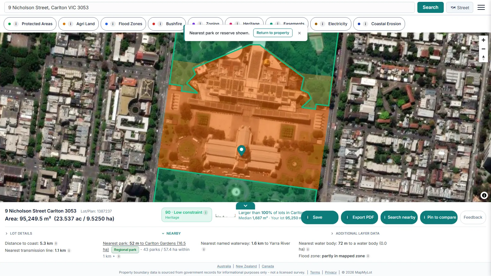
A "leafy pocket" in a listing can mean a genuine local park, or it can mean a single street tree and a strip of council nature strip nobody would call green space. MapMyLot shows the nearest park's name, its straight-line distance from the parcel boundary, and a size tier, pocket, neighbourhood, or regional, based on the park's mapped hectare area, sourced from OpenStreetMap contributors. Alongside the nearest park, the readout counts how many separate parks and how many total hectares of green space sit within a 1 kilometre straight-line radius, which is a measure of nearby mapped green space rather than a single nearest-park number that can be misleadingly close or misleadingly far on its own.
A single nearby park can be a pocket park barely bigger than a backyard, so the count-and-hectare figure inside the 1 kilometre radius is often the more useful number for anyone asking whether a street is actually walkable to real green space, versus technically adjacent to a token one. The size tiers themselves are MapMyLot's own estimate, tuned to the way parks are typically described in these markets, not an official government classification.
The distance is straight-line, not a walking route around roads or fences, and a property with no park reading may simply sit somewhere the underlying park dataset has not been loaded yet. Read the full park proximity guide for coverage and how the size tiers work.
Waterways

A listing that mentions a "creek at the back fence" and a listing that says nothing about the waterway two paddocks over are describing the same class of property two different ways, and neither is a measurement. MapMyLot measures the straight-line distance from the parcel's full boundary to the nearest named river, creek, or canal, and shows a second, unnamed-waterway reading only when a closer but unnamed watercourse exists. Both are sourced from OpenStreetMap contributors' community-mapped river, creek, and canal data.
Proximity to water raises real questions beyond scenery: flood exposure, insurance, and easements can all trace back to a nearby watercourse, and a straight-line distance is a faster starting point than working it out from a paper map. The reading is not a walking distance, the actual route may be longer or may not provide public access, and it is not a flood determination on its own - check the separate flood zone reading for that question. Read the full waterway proximity guide for exact coverage and the named/unnamed distinction.
Water bodies
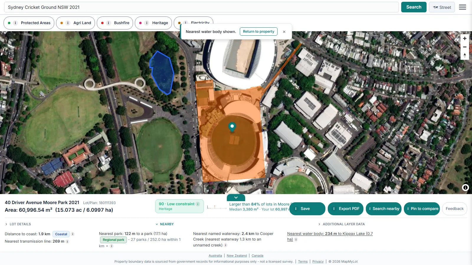
"Lakeside" in a listing can mean genuine frontage on a named lake, or it can mean a stormwater retention pond visible from an upstairs window. MapMyLot shows the nearest lake, pond, or reservoir's name, its straight-line distance from the parcel boundary, and its area in hectares as a pond, small lake, or lake size band, sourced from the same OpenStreetMap water data as the waterway reading.
The size band turns a bare area figure into something a reader can picture at a glance, and it exists precisely because "lakeside" on its own carries no information about scale. As with every proximity signal, the distance is straight-line and an absent reading means no mapped water body was found nearby, not confirmation of dry land. Read the full water body proximity guide for the size bands and exact coverage.
Coverage and accuracy
Proximity data depends on government datasets that vary by jurisdiction and are updated on their own schedule. Coverage differs per signal:
- Coast, park, waterway, and water body distance: Australia (QLD, NSW, VIC, TAS, ACT), New Zealand, the UK, and British Columbia
- Power line distance: the same list, plus Yukon, but not New Zealand or the UK
- Flood zone distance: Victoria, the UK, New Brunswick, and Queensland (sparse)
See each guide linked above for the exact current list. A distance shown by MapMyLot is a starting point for research, not a substitute for council records, a flood certificate, or a licensed survey; always confirm anything material to a purchase or finance decision directly with the relevant authority.
Use distance to compare, then check access
Coastal labels are MapMyLot distance bands, not confirmation of beach frontage or public access. A nearby park or waterway may have no entrance on the closest edge. Use a route map and an inspection to check how you would actually reach it.
Check a property's proximity now
Check an address freeAll six distances are free. Coverage varies by jurisdiction - see each guide for the current list.
Frequently asked questions
Are these distances measured from the house or the property boundary?
Is this a walking distance or a straight line?
Does an absent readout mean the property is safe from that risk?
Is my area included?
Coverage differs per signal:
- Coast, park, waterway, and water body distance: Australia (QLD/NSW/VIC/TAS/ACT), New Zealand, the UK, and British Columbia
- Power line distance: the same, plus Yukon, but not NZ or the UK
- Flood zone distance: Victoria, the UK, New Brunswick, and Queensland (sparse)
See each guide linked above for the exact list.