How to find your property boundary in Scotland
On this page
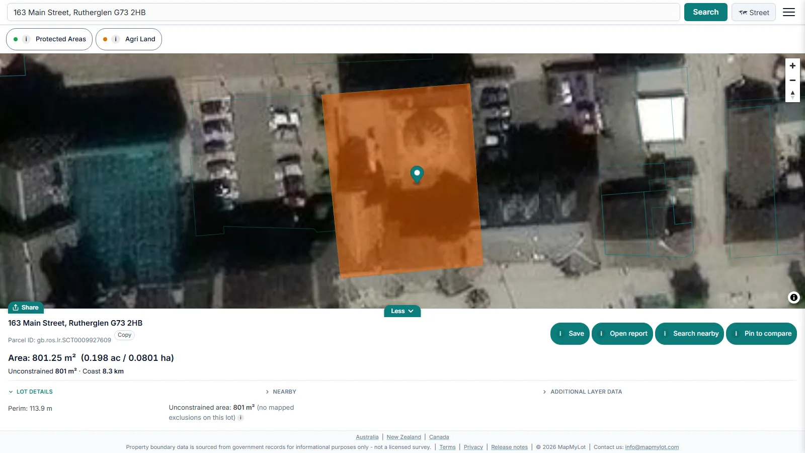
Search a Scottish street address on MapMyLot and the Registers of Scotland cadastral parcel for that property loads as a highlighted outline, with its area and perimeter. Five lookups a day are free, with no account and no title number needed. Scotland is part of MapMyLot's UK coverage, with about 1.56 million parcels. Treat the outline as a first look: the source data shows the indicative extent of a registered title, not a surveyed legal boundary.
Find your Scottish property boundary now - free, no account needed
Check an address freeFive free address lookups a day, no account needed. Additional readouts depend on local data coverage.
Land Register and Sasine Register
Scotland has two property registers. A property in the Land Register has a title sheet and a title plan. The title sheet is the official document Registers of Scotland provides for the property, and the title plan, based on the Ordnance Survey map, shows its position and boundary. A property still in the Sasine Register has a search sheet instead: a chronological list of deeds recorded against the property or area of land.
This matters for the map. Registers of Scotland states that "Only property registered in the Land Register is available in the cadastral parcels dataset." If a property has not yet moved onto the Land Register, there may be no parcel for it, and a search can land on a neighbouring parcel or find nothing.
What the cadastral parcel shows
MapMyLot's Scottish boundaries come from the RoS INSPIRE Cadastral Parcels dataset, published by Registers of Scotland under the Open Government Licence v3.0. The dataset describes each polygon as the "indicative extent of ownership" of a registered property. Parcels are captured against Ordnance Survey large-scale mapping at 1:1,250 in urban areas, 1:2,500 in semi-rural areas and 1:10,000 in rural areas. Registers of Scotland also says that "the extent of rights and land contained within a title registered in the land register cannot be established from the cadastral parcel."
The dataset is updated quarterly, so a title registered in the last few months may not show yet. In practice the outline is good for checking which parcel a property sits on, its rough size and shape, and how it relates to its neighbours. It is not the title plan, and it does not settle where a wall or fence should stand.
Title numbers and ScotLIS
Each Land Register title has a title number made of three capital letters followed by digits, for example MID15313. You do not need it to use MapMyLot, which searches by address. If you need the official documents, ScotLIS, the Registers of Scotland online service, sells a title sheet and title plan for £3.00 plus VAT. The ScotLIS map preview is, in its own words, "for indicative purposes only", so the purchased title plan is the document to rely on. ScotLIS cannot currently supply Sasine search sheets.
What you get from the search
The readout shows land area in square metres and hectares, perimeter in metres, and the straight-line distance to the coast. Two free overlay layers cover Scotland: protected areas (Special Areas of Conservation, Special Protection Areas and Ramsar sites, from JNCC) and agricultural land capability classes from the James Hutton Institute.
MapMyLot Pro's flood, heritage and coastal erosion overlays do not cover Scotland yet, and power line and park distances are not available for UK addresses. In Scotland, Pro (£29.99 a month) is about volume: it removes the five-a-day limit and includes unlimited PDF reports. A single PDF report costs £19.99 without a subscription. To see how the map works south of the border, read the England and Wales guide. For the general method, see how to find property boundaries.
Check an address in three steps
- Open the map, type the house number, street and town, and select the matching result.
- Check that the highlighted parcel is the property you meant. If the search lands on the wrong one, click your parcel on the map.
- Read the area and perimeter, switch to satellite view for context, and compare the outline with your title plan if you have one.
When you need more than a map
For a question about what a title includes, such as a disputed strip of garden or a right of access, speak to a solicitor, who can read the title sheet and the deeds. To mark or measure a boundary on the ground, instruct a chartered land surveyor. Take the MapMyLot outline along as a starting point, not as evidence.
Boundary data: contains Registers of Scotland data © Crown copyright and database right 2025, used under the Open Government Licence v3.0.
Find your Scottish property boundary now - free, no account needed
Check an address freeFive free address lookups a day, no account needed. Additional readouts depend on local data coverage.
Property boundary maps by region
Frequently asked questions
What data does MapMyLot use for Scottish property boundaries?
Do I need a title number to search?
Why is there no boundary for my property?
Is my area included?
Scotland is covered with about 1.56 million Registers of Scotland cadastral parcels across all 33 registration counties. MapMyLot also covers:
- Rest of the UK: England and Wales
- Australia: Queensland, New South Wales, Victoria, Tasmania, and the ACT
- New Zealand
- Canada: British Columbia, Manitoba, New Brunswick, and Yukon