How far is a property from a power line? Check the real distance
On this page
Search a covered address on MapMyLot to see the straight-line distance from the property boundary to the nearest mapped high-voltage transmission corridor. The reading helps you identify nearby infrastructure and questions to investigate; it does not measure exposure or establish a safe distance for a home.
Check a property's distance to power lines
Check power line distanceMapped in 7 jurisdictions. See the coverage list below.
Why the boundary, and why 33kV
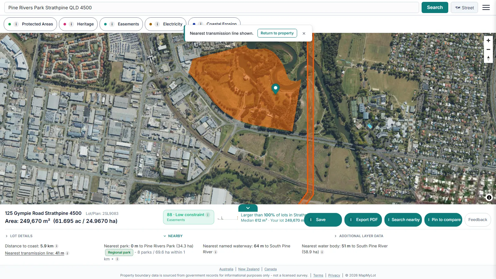
The distance is measured from the parcel's full boundary geometry, not its centroid - a large block can have one edge much closer to a corridor than the middle of the lot suggests, and centroid-based measurement would understate that. The 33kV threshold defines which mapped transmission infrastructure this readout includes; ordinary low-voltage lines serving individual streets are not flagged, since almost every property has one nearby and it would make the signal meaningless.
What the distance does and does not tell you
It is a straight-line measurement to the nearest mapped corridor edge, not a health or safety assessment and not a valuation. Research on proximity to high-voltage infrastructure and property values is genuinely mixed, and any effect depends heavily on the specific line, the specific market, and whether the line is visible from the property. Treat the distance as a starting point for your own research, a conversation with your lender, and (where it matters to you) independent advice - not a verdict.
Coverage
Power line distance is currently live where electricity infrastructure data has been loaded, sourced from the Digital Atlas electricity transmission lines dataset in Australia, and the BC Transmission Lines dataset in Canada:
- Australia: Queensland, New South Wales, Victoria, Tasmania, and the ACT
- Canada: British Columbia and Yukon
Not yet covered:
- New Zealand
- UK
- Canada: Manitoba and New Brunswick
A lookup with no powerline reading means no mapped 33kV+ corridor was found nearby, not a guaranteed absence.
Related proximity checks
Power lines are one of six proximity signals MapMyLot surfaces automatically from a single address search. See the proximity overview for how distance to flood zones, the coast, and parks are calculated the same way, jump straight to the flood zone check guide, or check a property's distance to the nearest lake or water body.
Always confirm anything material to a purchase or finance decision with the relevant authority or your lender directly.
Can this tell me a safe distance from power lines?
No. Distance to a mapped corridor is not a measurement of electric or magnetic fields at a house. For health information, consult ARPANSA's powerline guidance. For building clearances and easement conditions, contact the network operator and check the property documents.
Check a property's distance to power lines
Check power line distanceMapped in 7 jurisdictions. See the coverage list below.
Frequently asked questions
Does MapMyLot flag every power line, or just high-voltage ones?
Why does the distance come from the boundary and not the house?
Does a lender care about the exact distance?
Is my area included?
Power line distance is currently live in:
- Australia: Queensland, New South Wales, Victoria, Tasmania, and the ACT
- Canada: British Columbia and Yukon
Not yet covered:
- New Zealand
- UK
- Canada: Manitoba and New Brunswick