How far is a property from the nearest park? Distance, size, and nearby green space
On this page
"Leafy" and "parkside" show up in listings for streets with a single street tree and a berm nobody would call green space. Search an address on MapMyLot and, where park data is available, the parcel readout shows the nearest park's name, straight-line distance, and a size tier - a real answer instead of a listing adjective. Tap the reading and the map highlights the actual park boundary the distance was measured against.
Check a property's distance to parks
Check an address freeFive free address lookups a day, no account needed. Additional readouts depend on local data coverage.
Distance, name, and size tier
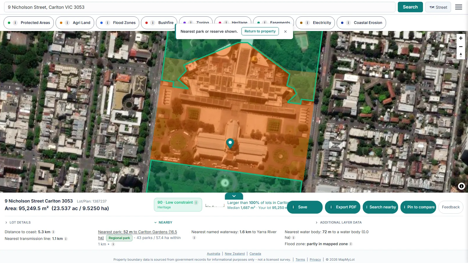
The nearest park is identified by name where the source data has one, with a size tier:
- Pocket - under 0.5 hectares (5,000 m2). A small local or corner reserve.
- Neighbourhood - 0.5 to under 5 hectares (50,000 m2). A typical suburban park with room for a playground or sports field.
- Regional - 5 hectares or more. A large district or regional park, often with multiple facilities.
A pocket park a short walk away is a very different amenity from a regional park the same distance away, and the tier makes that distinction visible at a glance instead of hiding it behind a single nearest-park number. These thresholds are MapMyLot's own classification for comparing green space, not an official standard.
Green space beyond the nearest park
Alongside the single nearest park, MapMyLot separately counts how many parks and how many total hectares of park land sit within a 1 kilometre straight-line radius of the property. This within-1km aggregate is a measure of nearby mapped green space - a property near one large regional park and a property surrounded by several small pocket parks can both show a short nearest-park distance, but very different overall green space access, and the 1km count is what tells them apart.
Coverage
Park distance is currently live where park data has been loaded, sourced from OpenStreetMap contributors:
- Australia: Queensland, New South Wales, Victoria, Tasmania, and the ACT
- New Zealand
- UK: England, Wales, and Scotland
- Canada: British Columbia
Not yet covered:
- Canada: Manitoba, New Brunswick, and Yukon
A property with no park reading may genuinely have no nearby mapped park, or it may sit somewhere park data has not been loaded for that jurisdiction yet - MapMyLot does not distinguish the two from the data alone, and never shows an absent reading as "none nearby".
Related proximity checks
Park distance is one of six proximity signals MapMyLot calculates automatically from a single address search. See the proximity overview, check a property's distance to the coast, or its distance to the nearest lake or water body.
Green space access is a genuine lifestyle factor for many buyers, whether that means a place to walk a dog, somewhere for kids to play, or simply a quieter outlook than a fully built-up street. Checking the nearest park distance and the 1 kilometre count together, rather than relying on a listing's description of leafy or parkside, gives a clearer picture before you inspect in person.
Check the route before relying on park access
The nearest park boundary may be a long way from its entrance. Check public access, opening hours, crossings and the route on foot before treating a short map distance as a convenient daily walk.
Check a property's distance to parks
Check an address freeFive free address lookups a day, no account needed. Additional readouts depend on local data coverage.
Frequently asked questions
What do the park size tiers mean?
Why does MapMyLot show a 1 kilometre count as well as the nearest park?
Is the distance a walking route?
Is my area included?
Park distance is currently live in:
- Australia: Queensland, New South Wales, Victoria, Tasmania, and the ACT
- New Zealand
- UK: England, Wales, and Scotland
- Canada: British Columbia
Not yet covered:
- Canada: Manitoba, New Brunswick, and Yukon
If your property is outside these areas, MapMyLot will not show a park reading rather than guessing at one.