What is my property zoned? Maps and official checks
On this page
MapMyLot Pro displays mapped land-use zoning in Victoria, Tasmania, the ACT and Manitoba. Search a covered address and open the Zoning layer to see the mapped zone beside the parcel. For other locations, or to confirm what you may build or do, use the relevant planning authority's map and scheme rules.
Check a property's zoning on the map
Check mapped zoningZoning overlays require Pro. Coverage: VIC, TAS, ACT and Manitoba. For other areas, use the relevant planning portal.
How to check a property's zoning
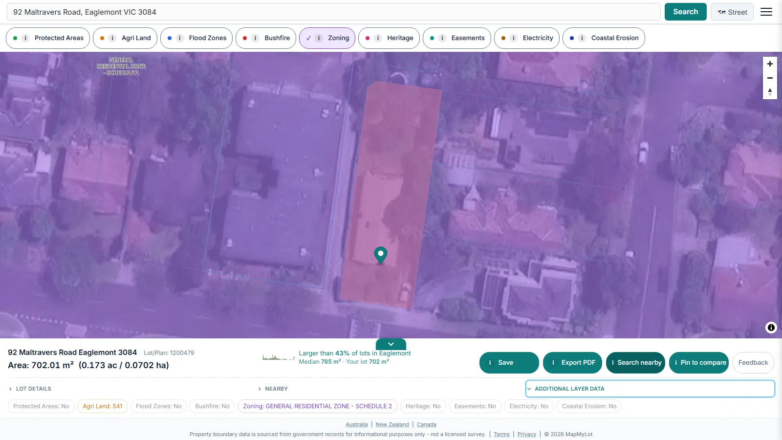
Search the address, then tap the Zoning layer pill. Where zoning data is loaded, MapMyLot draws the zone boundary on the map - like the General Residential Zone shown above in Eaglemont, Victoria - so you can see exactly how the zone lines up against the property, not just a code with no visual context.
What the readout shows

Tapping the Zoning pill adds a zoning indicator to the property readout alongside boundary, lot size, and proximity data from the same address search.
What a zone actually determines
A zone, set by the relevant local planning scheme, is one of the biggest single factors in what you can legally do with a property. It sets what's permitted without a planning permit, subject to the scheme's conditions and any other approvals, what needs a planning permit, and what's prohibited outright - covering everything from running a home business or a second dwelling to commercial use or subdivision potential. The same physical block of land can be worth very different things to different buyers depending purely on its zone.
Zone codes explained
Zone names and codes vary by state and planning framework - "General Residential Zone", "Rural Living Zone", and similar Victorian Planning Provisions names are self-explanatory once mapped, but some jurisdictions use bare alphanumeric codes. One common example is R2: in the New South Wales Standard Instrument framework, R2 means Low Density Residential. NSW zoning is not currently loaded in MapMyLot (see coverage below), so an R2-coded property can't be checked here yet - the NSW Planning Portal is the place to confirm it today.
Checking a New South Wales property
MapMyLot's zoning layer does not yet cover New South Wales. For a NSW address, use the NSW Planning Portal Spatial Viewer to check the zone directly. MapMyLot can still do a lot for a NSW property in the meantime: its exact boundary and lot area, a free proximity check against nearby parks, water, and powerlines.
Is my area covered?
MapMyLot's zoning layer is currently live in:
- Victoria
- Tasmania
- The ACT
- Manitoba
Not yet covered:
- New South Wales
- Queensland
- New Zealand
- Canada: British Columbia, New Brunswick, and Yukon
- The UK
If a property sits outside the covered list, MapMyLot has no zoning data for it yet - check the relevant state, territory, or provincial planning portal directly for an authoritative zoning determination before relying on it for a purchase or development decision.
Check a property's zoning on the map
Check mapped zoningZoning overlays require Pro. Coverage: VIC, TAS, ACT and Manitoba. For other areas, use the relevant planning portal.
Frequently asked questions
Is my area covered?
MapMyLot's zoning layer is currently live in:
- Victoria
- Tasmania
- The ACT
- Manitoba
Not yet covered:
- New South Wales
- Queensland
- New Zealand
- Canada: British Columbia, New Brunswick, and Yukon
- The UK