Heritage overlay: what it is, and how to check one
On this page
If you searched "heritage overlay", you're almost certainly asking about a local council planning-scheme control - most commonly in Victoria - not a state or national heritage register listing. The two are different systems, and mixing them up can mean missing a real restriction on a property. This guide explains the distinction first, then shows what MapMyLot's Heritage layer actually covers.
Check a property's state heritage register status
Check mapped heritageMapMyLot Pro checks mapped heritage listings. For local heritage overlays, use VicPlan or your council planning map.
Heritage overlay vs heritage register: the distinction that matters
A heritage overlay is a control set by a local council's planning scheme - in Victoria, a "Heritage Overlay" (HO) with its own schedule of conditions, which can apply to a single property or to an entire precinct of houses. A state or national heritage register listing is a separate designation made under state or national heritage legislation, generally reserved for places of state-level or national-level significance. A property can have a heritage overlay with no state listing, a state listing with no local overlay, both, or neither - they are not the same list, and checking one does not tell you about the other.
What MapMyLot's Heritage layer actually shows
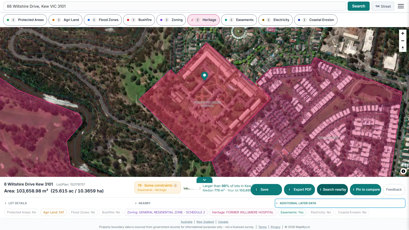
To be direct about this: MapMyLot's Heritage layer covers state and national heritage register listings only. Local heritage overlay precincts - including Victorian Heritage Overlay schedules - are not currently loaded into MapMyLot. The image above shows the Former Willsmere Hospital, a Victorian Heritage Register listing in Kew - a genuine, real state-register entry - to illustrate what the layer does show, not a heritage overlay precinct.
How to check a heritage overlay
For a Victorian property, check VicPlan directly and search the address for a Heritage Overlay (HO) schedule, or contact the local council's planning department - they administer the overlay and can confirm both its existence and its specific conditions. Other states and territories use different local heritage instruments with their own names and processes; the local council or planning authority is always the authoritative source for a local heritage overlay, wherever the property sits.
What a heritage overlay restricts
A heritage overlay typically requires a planning permit for demolition, external alterations, and some new development - including changes that would not otherwise need council sign-off on a non-overlay property. Because the specific controls are set by the schedule attached to that particular overlay, they can vary meaningfully between one heritage-overlay property and its neighbour, so the local planning scheme entry for that address is the detail to check, not a general assumption.
What MapMyLot can check right now
While the local overlay itself sits outside MapMyLot's current data, the same address search that checks the state heritage register also returns the property's mapped boundary and lot area and a free proximity check against nearby parks, water, and powerlines - useful context alongside whatever the council confirms about the overlay. For the state and national register question specifically, see the heritage-listing pillar guide, the NSW State Heritage Register guide, or the Queensland Heritage Register guide.
Check a property's state heritage register status
Check mapped heritageMapMyLot Pro checks mapped heritage listings. For local heritage overlays, use VicPlan or your council planning map.