Buildable area and frontage: what MapMyLot estimates and why
On this page
MapMyLot estimates unconstrained area by subtracting selected mapped constraints from the mapped parcel area, and estimates frontage from parcel geometry. Use these figures to screen a block before further investigation. They do not establish the legal title area, apply building setbacks or define a council-approved building envelope.
Check a property's buildable area and frontage
Check area and frontageFive free address lookups a day, no account needed. Additional readouts depend on local data coverage.
What the readout shows
In the example above, a 404 m² mapped parcel area reduces to a 344 m² unconstrained estimate - a genuine 15% reduction, driven by a mapped easement crossing the block - alongside a 13.0 m frontage estimate. Both figures sit in the property readout's Lot Details, right next to the mapped parcel area they're measured against.
See it on the map
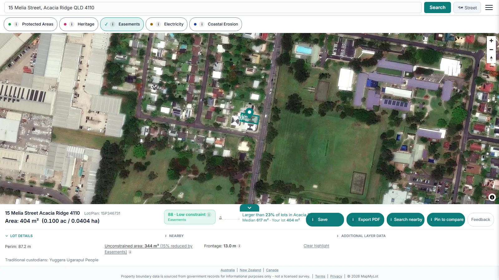
Tap the unconstrained-area readout and MapMyLot highlights the buildable extent directly on the map - so you can see roughly where on the lot the constraint sits, not just a subtracted number with no spatial context.
How the buildable area is calculated
Unconstrained area is the property's mapped parcel area minus any mapped exclusionary constraints: easements, protected areas, heritage listings, electricity corridors, and coastal erosion zones. Flood zones and bushfire-prone areas are deliberately NOT subtracted from this figure - they trigger construction standards (like a Bushfire Attack Level assessment) rather than an outright prohibition on building within the mapped area, so folding them into a smaller "buildable" number would overstate what they actually restrict. Where nothing reduces the figure, MapMyLot says so explicitly rather than showing the raw mapped parcel area with no qualifier.
How the frontage estimate is calculated
The frontage estimate measures the property's primary open boundary length - the longest edge not shared with a neighbouring lot - trimmed by a small tolerance where it meets an adjoining property, so a party wall or shared side boundary isn't miscounted as open frontage. It reads slightly shorter than the raw cadastral edge length labelled on the map for that reason; both numbers are correct, they just measure different things.
What these estimates are not
Both figures are estimates from mapped cadastral and constraint-layer geometry - useful for an early screen, not a licensed survey, a council-approved building envelope, or a setback calculation. Local planning controls (minimum setbacks, site coverage limits, height restrictions) apply on top of the physical buildable area and are not captured here. Confirm the real build envelope with council planning advice or a registered surveyor before relying on either number for a purchase or design decision.
Related reading
Buildable area accounts for mapped easements crossing the lot - see the easements guide for what an easement is and how to check for one directly. For the property's mapped title boundary and area, see how big is my block of land.
Check a property's buildable area and frontage
Check area and frontageFive free address lookups a day, no account needed. Additional readouts depend on local data coverage.